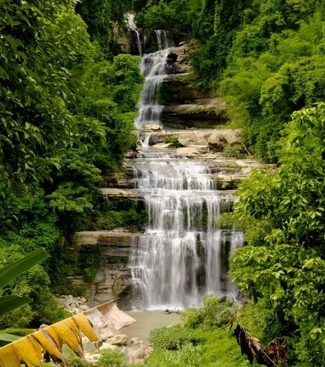
Mizoram is a
state in northeastern India, with Aizawl as its capital city. The name is
derived from "Mizo", the name of the native inhabitants, and
"Ram", which means land, and thus Mizoram means "land of the
Mizos".
Mizoram
terrain is, according to Geological Survey of India, an immature topography,
and the physiographic expression consists of several, almost North-South
longitudinal valleys containing series of small and flat hummocks, mostly
anticlinal, parallel to sub-parallel hill ranges and narrow adjoining synclinal
valleys with series of topographic highs. The general geology of western
Mizoram consists of repetitive succession of Neogene sedimentary rocks of Surma
Group and Tipam Formation viz. sandstone, siltstone, mudstone and rare pockets
of shell limestone. The eastern part is Barail Group. Mizoram, lies in seismic
zone V, according to the India Meteorological Department; as with other
northeastern states of India, this means the state has the highest risk of
earthquakes relative to other parts of India.

The biggest
river in Mizoram is Chhimtuipui, also known as Kaladan, Kolodyne or Chimtuipui.
It originates in Chin state in Burma and passes through Saiha and Lawngtlai
districts in the southern tip of Mizoram, goes back to Burma's Rakhine state.
Although many more rivers and streams drain the hill ranges, the most important
and useful rivers are the Tlawng, Tut, Tuirial and Tuivawl which flow through
the northern territory and eventually join the Barak River in Cachar District.
The rivers have a gentle drainage gradient particularly in the south.

Aizawl is
the capital of the state of Mizoram in India. With a
population of 293,416,it is the largest city in the state. It is also the
centre of administration containing all the important government offices, state
assembly house and civil secretariat. The population of Aizawl strongly
reflects the different communities of the ethnic Mizo
people.

Serchhip is
the headquarters town of Serchhip district in the Indian state of Mizoram, and
also the headquarters of Serchhip Sadar subdivision. It lies in the central
part of Mizoram, and 112 km away from the State capital city of Aizawl. The
district has the highest literacy all over India.

Champhai is
a border town in Mizoram state, in far eastern India. It is the headquarters of
Champhai district, one of the eight districts in the state. It is located on
the Indo-Myanmar border and is situated in a strategically important location.

Ṭam Dil Lake is a reservoir lake situated 6 km from Saitual, the nearest
town, and 64 km from Aizawl, the capital city of Mizoram, India. In Mizo
language, the word Ṭam is a contraction of anṭam, which means a mustard plant;
and Dil means "lake"

Phawngpui , also known as Blue Mountain is the highest mountain peak in
the Mizoram and in the state of Mizoram, India, with an elevation of 2157 m. It
is located in Lawngtlai district, in the southeastern region of Mizoram near
the Myanmar border.
No comments:
Post a Comment